The Woman Who Saw What No One Else Could
In a cramped office at Columbia University in the 1950s, Marie Tharp spent her days drawing mountains that had never seen sunlight. Working with depth measurements collected by research ships, she was creating the first detailed maps of the Atlantic Ocean floor—terrain more mysterious than the surface of the moon.
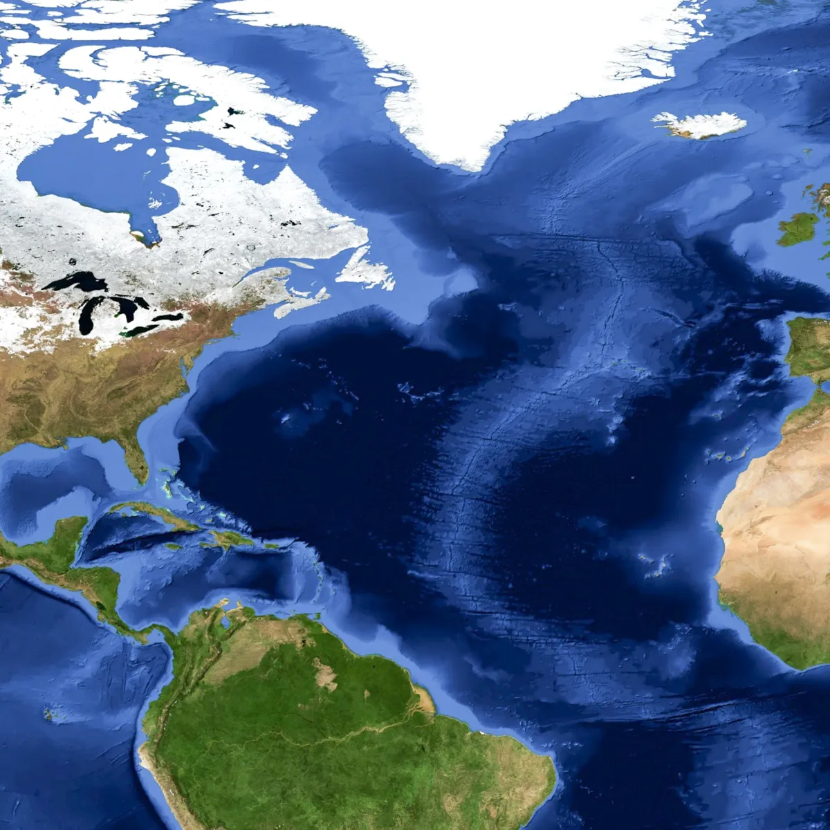 Photo: Atlantic Ocean, via i.natgeofe.com
 Photo: Columbia University, via www.e-architect.com
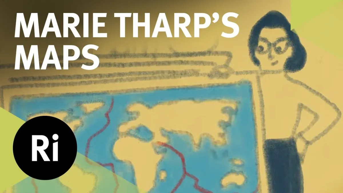 Photo: Marie Tharp, via i.ytimg.com
Her male colleagues thought she was wasting time on women's work. The scientific establishment dismissed her findings as impossible. But Tharp was seeing something that would revolutionize geology: proof that the Earth's surface was constantly moving, reshaping itself through forces no one fully understood.
She just needed the world to believe what her maps were showing.
Drawing in the Dark
Tharp's journey to mapping the ocean began with limitation, not opportunity. In the early 1950s, women weren't allowed on research vessels, so while her colleague Bruce Heezen sailed the Atlantic collecting sonar data, Tharp remained in New York, transforming numbers into images.
This restriction, meant to exclude her from real scientific work, became her greatest advantage. While field researchers saw individual data points, Tharp saw patterns. While they focused on specific measurements, she studied the bigger picture emerging from thousands of depth readings.
"I had the whole ocean in front of me," Tharp later recalled. "Not just pieces of it, but the entire seafloor spreading out like a landscape I could walk through in my mind."
Working with pencils, rulers, and extraordinary patience, Tharp began plotting the topography of the deep Atlantic. Each sonar measurement became a point on her growing map. Each research cruise added new details to her underwater world.
What emerged from her careful drafting was stunning: the ocean floor wasn't the flat, featureless plain that scientists expected. It was a landscape of mountains, valleys, and most importantly, a massive ridge running down the center of the Atlantic like a backbone.
The Discovery They Called 'Girl Talk'
By 1952, Tharp had identified something extraordinary in her maps: a continuous rift valley running along the center of the Mid-Atlantic Ridge. This wasn't just interesting geology—it was evidence for one of the most controversial theories in Earth science.
For decades, a few scientists had proposed that continents slowly drifted across the planet's surface, but the idea was widely dismissed as impossible. How could solid rock move? What force could push entire continents around the globe?
Tharp's rift valley provided an answer. If new seafloor was being created at the ridge and spreading outward, it could push continents apart over millions of years. The ocean floor wasn't permanent—it was a conveyor belt, constantly renewing itself and reshaping the planet.
When Tharp presented her findings to Heezen, his response was immediate and dismissive: "It cannot be. It looks like continental drift, and that is impossible."
Other colleagues were even less diplomatic. They called her interpretation "girl talk" and suggested she stick to drafting instead of theorizing. The idea that a woman working with secondhand data could solve one of geology's greatest mysteries seemed absurd to the men who controlled academic science.
Patience Versus Prejudice
Tharp's response to dismissal was methodical persistence. If her colleagues wouldn't accept her interpretation, she would make her evidence undeniable. She expanded her mapping project, creating detailed charts of more ocean basins. She refined her techniques, improving the accuracy of her depth calculations.
Most importantly, she continued seeing what others missed. Her maps revealed that the rift valley wasn't unique to the Atlantic—it was part of a global system of underwater ridges that circled the planet like the seam on a baseball.
"I was mapping a connected system," Tharp explained years later. "Not separate features, but one enormous geological machine that was actively reshaping the Earth's surface."
The breakthrough came when earthquake data was overlaid on Tharp's maps. The correlation was perfect: earthquake epicenters aligned precisely with her rift valleys. The ocean ridges weren't just geological features—they were active boundaries where the Earth's crust was splitting apart.
Suddenly, Tharp's "girl talk" looked like genius.
Recognition and Revolution
By the early 1960s, the scientific community could no longer ignore Tharp's work. Her maps became the foundation for the theory of plate tectonics, which explained how the Earth's surface consists of moving pieces that interact at their boundaries.
The implications were revolutionary. Earthquakes, volcanoes, mountain building, and continental drift could all be explained as consequences of plate movement. Geology transformed from a descriptive science into a unified theory of how the planet works.
Tharp's maps were featured in National Geographic, displayed in museums, and studied in classrooms worldwide. The woman who had been excluded from research ships became the person who drew the definitive portrait of the ocean floor.
"Marie's work was the missing piece," explained geologist Walter Pitman. "We had theories and we had data, but we didn't have the visual evidence that made it all make sense. Her maps provided that evidence."
The Art of Scientific Truth
What made Tharp's contribution unique wasn't just her technical skill—it was her ability to see patterns in data that others treated as isolated measurements. Her maps weren't just scientific documents; they were works of art that revealed the hidden beauty of the planet's structure.
Tharp understood that science is often about visualization—making the invisible visible, translating abstract concepts into images that people can understand. Her hand-drawn maps communicated geological truths more effectively than any equation or research paper.
"I spent my career making pictures of things no one could see," Tharp reflected near the end of her life. "But once people could see them, everything changed."
The Legacy Beneath Our Feet
Today, Marie Tharp's maps hang in geology departments worldwide, and her techniques form the foundation of modern oceanography. Satellites and computer modeling have refined our knowledge of the seafloor, but the basic picture she drew in the 1950s remains accurate.
More importantly, her story illustrates how scientific breakthroughs often come from unexpected places. The woman who wasn't allowed on research ships ended up creating the most important maps in Earth science. The "girl talk" that colleagues dismissed became the evidence that revolutionized geology.
Tharp's career reminds us that exclusion sometimes creates unique perspectives. By forcing her to work with data rather than direct observation, the scientific establishment inadvertently gave her the distance necessary to see patterns that field researchers missed.
In a basement office at Columbia University, armed with pencils and extraordinary vision, Marie Tharp drew the portrait of our moving planet. The world just took a while to recognize the artist.